State Street
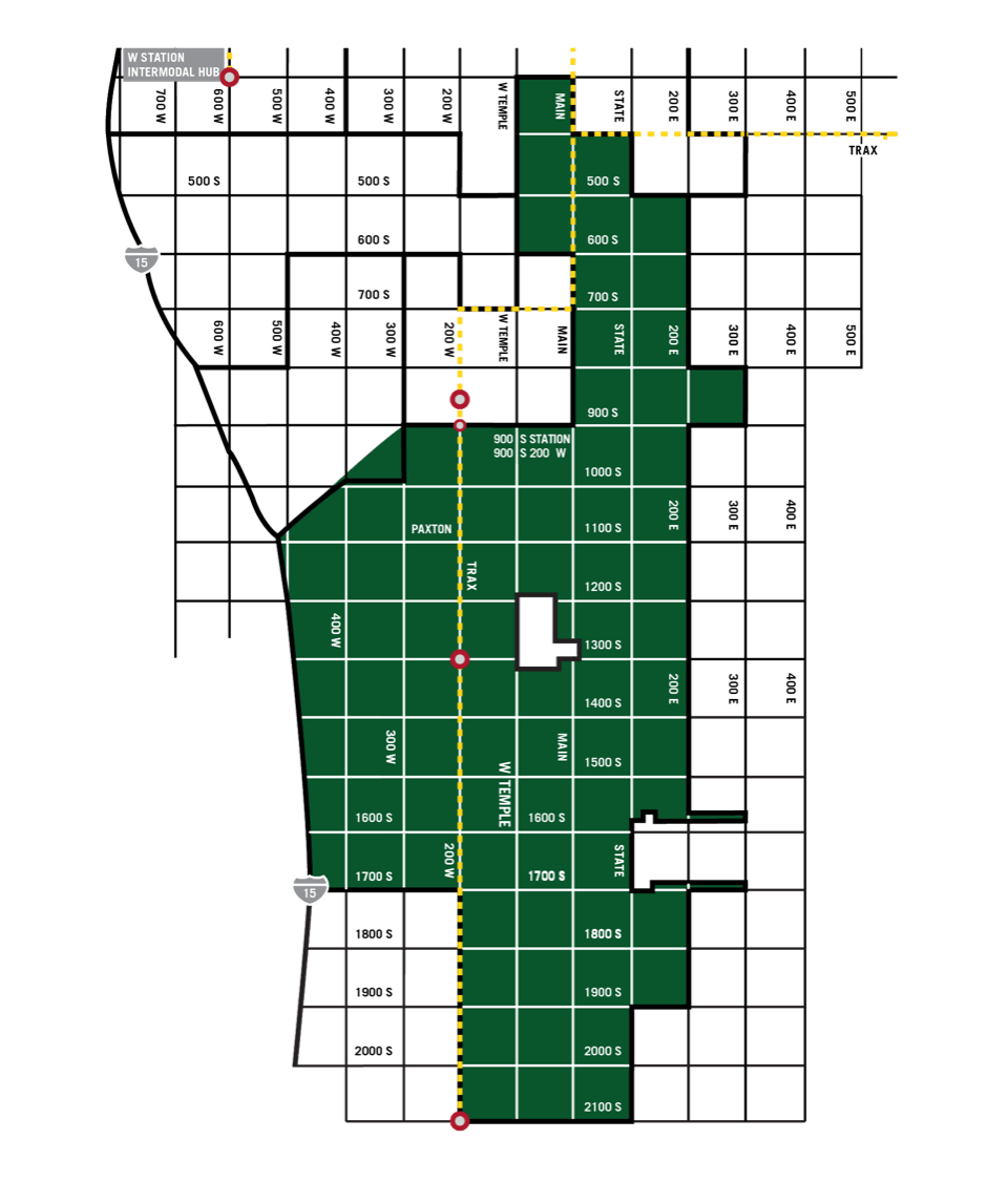
Covering a large expanse of Salt Lake City, the State Street Project Area is bounded by: 2100 South and 300 South on the south and north; Interstate-15, 200 West, and West Temple on the west; and 200 East on the east. It is comprised of a range of districts and neighborhoods with differing land uses, urban design characteristics, and transportation features. A key component of the project area is State Street, once the primary north/south highway connecting Salt Lake City with adjacent cities prior to the construction of Interstate-80 and Interstate-15. This automobile-focused corridor continues to be a critical gateway to Salt Lake City. There is opportunity to expand the street’s uses by including more pedestrian-friendly and livable features through infrastructure enhancement and creation. There is also opportunity for new development, the renovation and rehabilitation of existing buildings, and the creation of safe, welcoming public spaces.

colony b
colony b is a transit-oriented residential development built with affordability and access in mind. Of the development’s 140 total studio- and one-bedroom units, 106 are rented at rates affordable to people earning 25 to 50% of the area median income (AMI). The RDA provided a $1.34 million loan to help finance colony b’s construction both because of its affordability and its intentional focus on serving vulnerable populations. Eleven (11) units are specially reserved for young people aging out of the foster care system, and 15 units are ADA-accessible. Additionally, it is steps away from the 1300 South TRAX station, enabling residents easy access to transit.


